
After Lasse celebrates his 21st birthday and a friend's birthday, my wife Sandra drives us to the airport. We fly to London and on to Dallas/Fort Worth, where we have a 4-hour layover. However, we are also busy here with the entry into the USA, which involves collecting our checked baggage, carrying it through customs and checking it in again. Apart from that, the immigration process is the same as always.
We land in Palm Springs, California, at 10.30 p.m. that same day, where Zoila and Axel pick us up from the airport. The FATHER AND SON TOUR 2 begins.
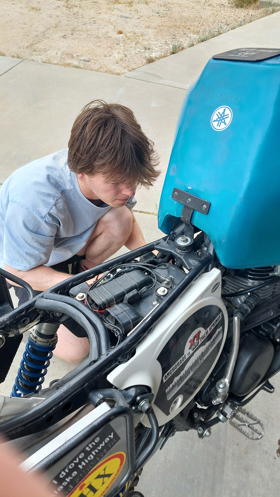
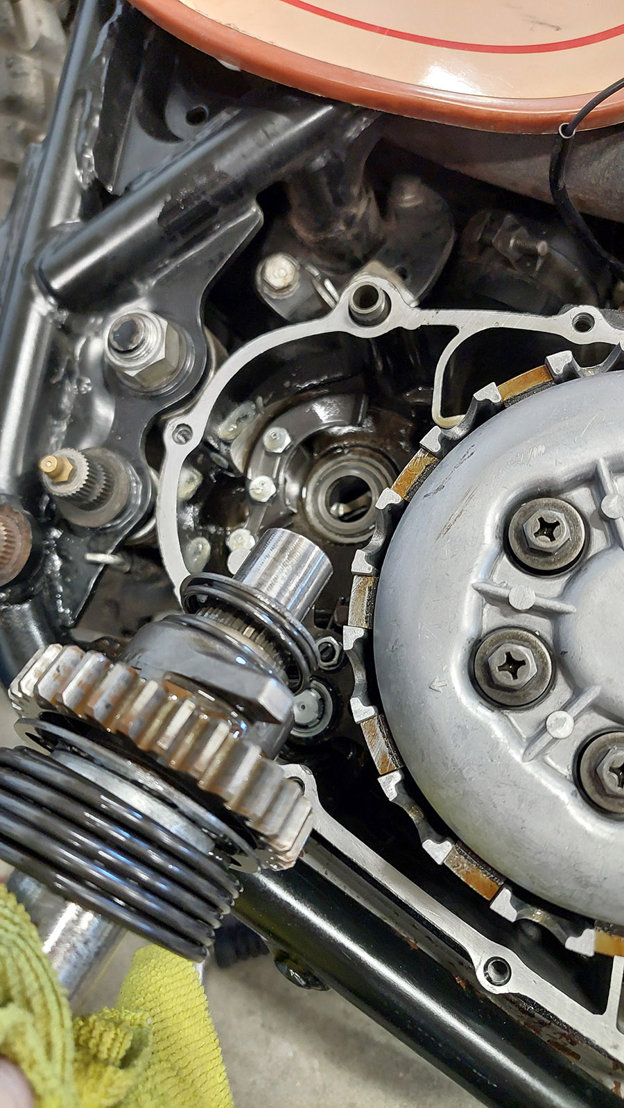
We tinker all day and get a lot done. With Axel's XT (which I'm riding again):
- New decorative train
- GPS and cell phone holder installed
- New rear tire
- Broken spoke replaced
On my XT (which Lasse rides)
- New overhauled carburetor
- New contact plate
- new kickstarter rubbers (both XTs)
- Valves adjusted
- Timing chain tensioned
- Ignition set
Here I present you my 1977 Ginger US XT.
I bought it at the end of 2017 and restored and rebuilt it in March 2018 and March 2019. The aim was to ride the TAT (Trans America Trail) with Peter in July 2019. We had the XTs transported to the east coast and then rode the TAT all the way to the west coast.
But that's another story: www.coast2.de
This is Axel's XT. He built it up in 2012 to ride it to Alaska with Peter ... unfortunately he had a lot of bad luck, two engine failures because the real fault wasn't found, but that's another story.
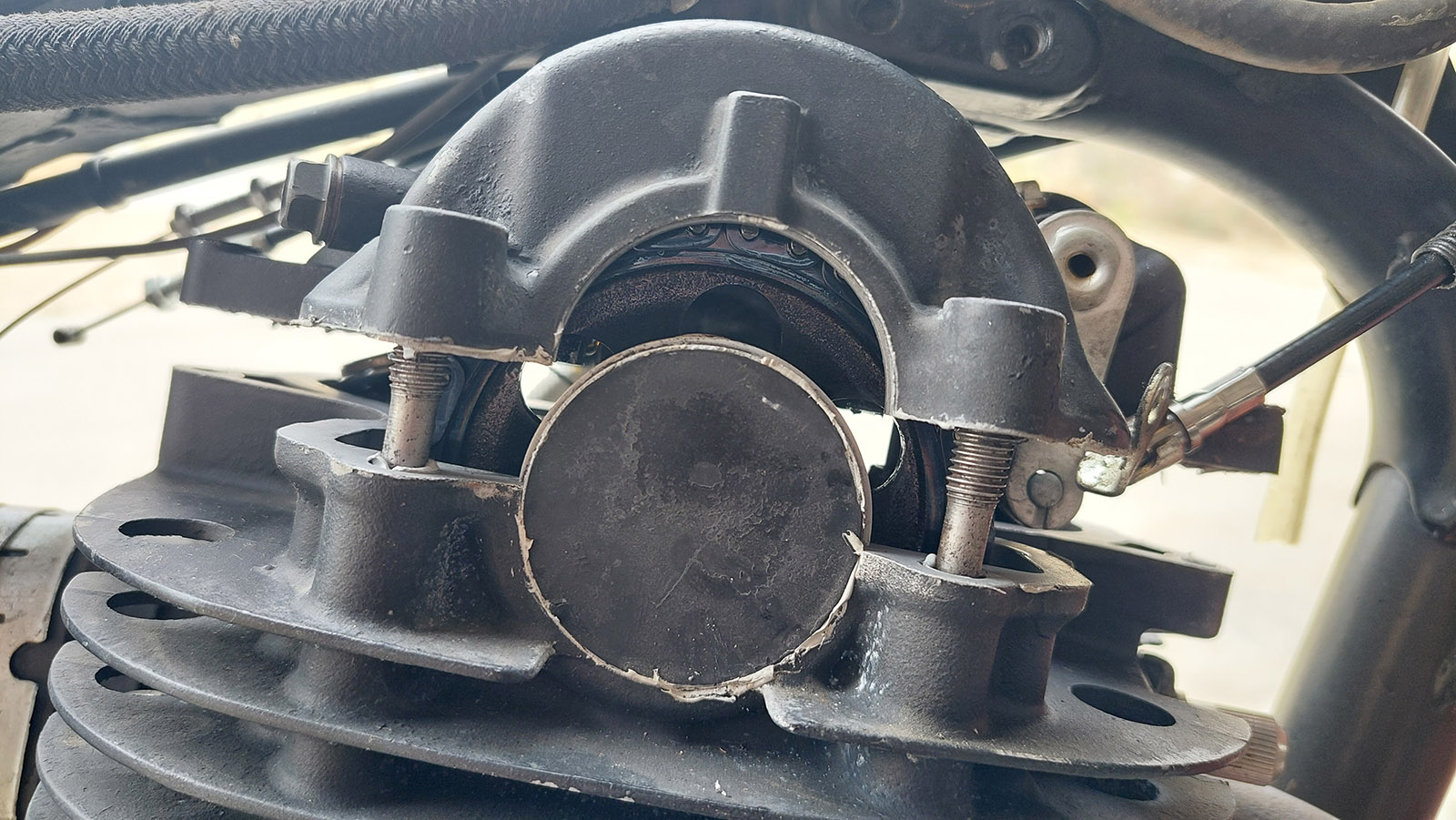
On the last trip with this XT it started very badly. Now, with an overhauled carburetor (brought along), a completely new contact plate and freshly adjusted ignition, it works well.
A mistake at the last moment, but it only turns out to be a minor problem. Don't soak the air filter too much with oil!
(XToms Tips & Tricks #538)
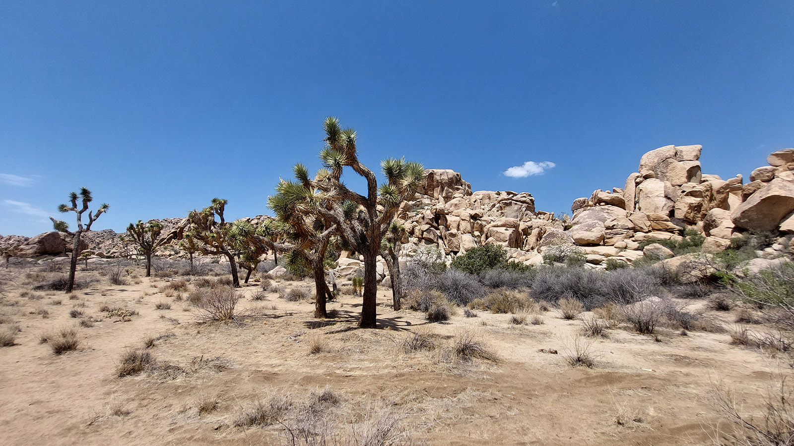
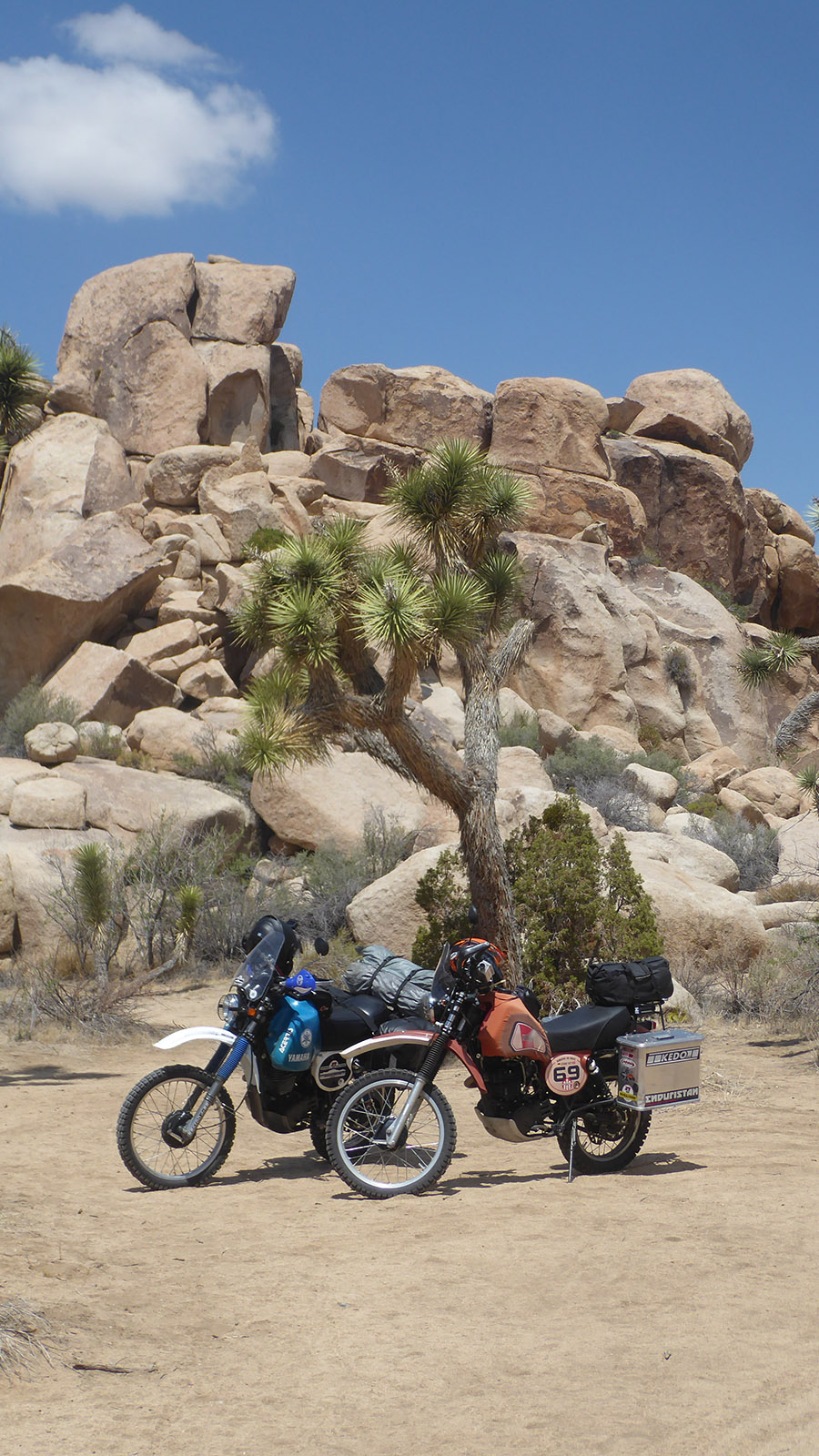
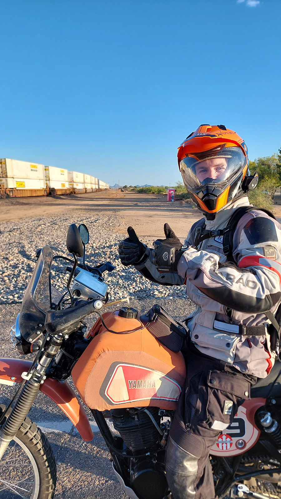
It was a good idea not to take off yesterday. A bad storm hit Joshua Tree Park and Twentynine Palms. Fortunately nothing happened here. Lasse has a cold, but he's feeling better and we're starting today.
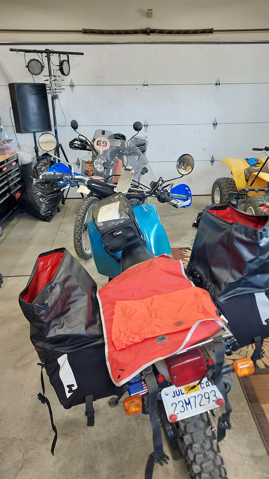
We set off at 09:30. We say goodbye to Zoila and Axel and head east. After buying water and medicine for Lasse at Walmart, we turn off into Joshua Tree National Park.
Break at 3.00 pm. We have cheese sticks with ketchup rolled up in slices of toast (not toasted, of course). After a total of around 200 miles (320km), we actually want to spend the night at a KOA campsite in Salome, but it's still blisteringly hot and the campsite is more of an RV park - i.e. for motorhomes. So we decide to drive on.
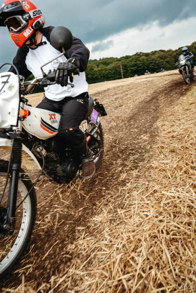
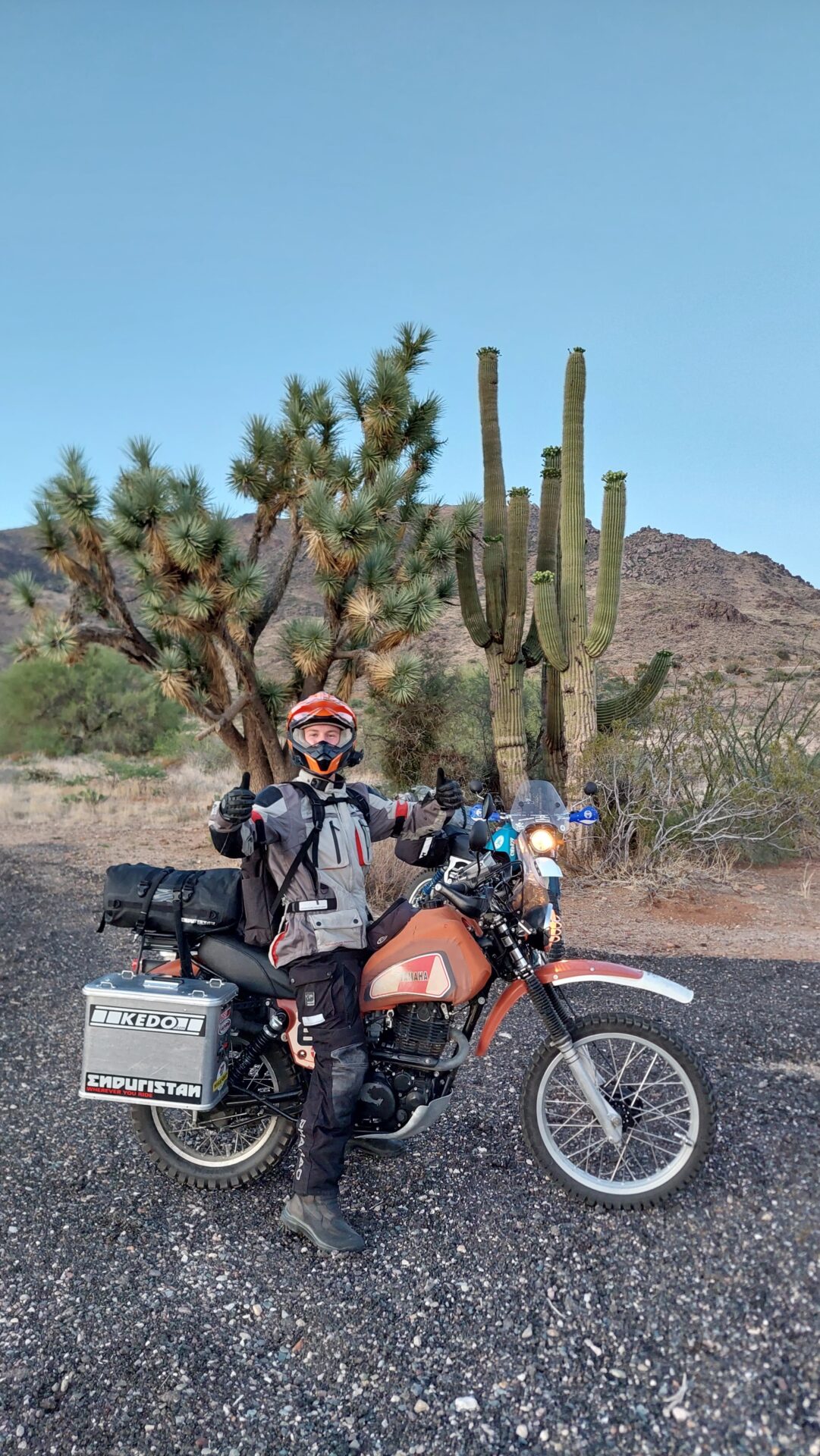
30 miles before Prescott, Lasse's engine suddenly stops. The rear wheel locks up and he struggles not to crash. The black mark on the road is considerable. Engine jamming! This can't be true. On the first day! Is it already over? The XT has used up all the oil. We top up with 800ml. I also spray chain grease into the spark plug hole and use the last rays of sunlight to loosen the exhaust valve a little. We are lucky! The engine has come loose and starts again. XT is indestructible! Everything has roller bearings - no plain bearings. A quick photo with an organ pipe cactus and on into the darkness. Our destination is a campsite that Robin and I had looked at but didn't take because of the rain and snow.
After 510 kilometers we reach the campsite at around 9 pm. It's at 1,650m and we're cold.
We only have two 100-dollar bills and can't deposit the required 18 dollars in the envelope ... never mind. We'll do it tomorrow.
Setting up the tent. Cooking. Chicken franks with noodles and ketchup.
Lasse agrees with Johny from Belgium, who always says: "If you travel with the Zündel, you pitch your tent in the dark!"
While Lasse gets a good night's sleep, I get up and remove his tank. Although I have little hope that the XT will then start better, I replace the ignition coil. I've got it with me, so it's worth a try.
Around 08.30 I drive to Prescott and buy oil, fuses, brake cleaner and milk. Unfortunately, the blue XT is now acting up. Feels like no gas. I make it back to the campsite. Tinkering, breakfast, packing, off I go.
10 miles later, we drain the fuel from the float chamber and poke around in the main nozzle. I assume there was some water in the gasoline. XT is running again. We buy another multimeter from NAPA to look for the fault in Lasse's electrics ... when we get the chance.
We cross a mountain range on a beautiful little highway (I recognize the turn-off where Robin and I took our first snow photos) and turn off onto gravel in Jerome.
We have the choice between Sedona and a gravel road that I had found on the web the evening before departure. I explain to Lasse that Sedona looks cool but is very touristy and populated. Lasse opts for the gravel road.
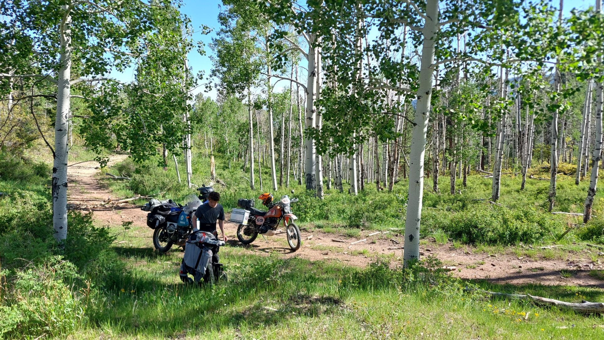
A break on the track, which is getting smaller and smaller. I have a sneaking suspicion that it is intended for jeeps and ATVs.
The slope became so rough and steep that Lasse tipped over. In the video, I had just helped to lift his XT up again.
We turn around, it would be stupid to suffer serious injuries or damage on the second day.
But the landscape is great!!!
We reach the Whitehorse Lake Campground via an old highway and settle in.
Noodles, salt and magnesium have risen in the aluminum cases during the shaking. A funny mixture. As we didn't go shopping, we eat all the leftovers.
As we were already in our sleeping bags at 9.30 p.m., we can get up at 7 a.m. today. The place is really nice. We set off for Sycamore Falls, but the parking lot there is very lonely and the hiking trail is at least 3 miles long. We don't want to leave the XTs with helmets and jackets alone for so long ... and we don't feel like lugging them around. So no Falls today.
The host at the campsite has already told us that there is a CAR SHOW in Williams this weekend. We end up in the middle of it.
There are some very cool cars to see. We have breakfast at the edge of the car show, buy some water and food and drive along the exhibition mile at walking pace to say goodbye.
The nightmare for every German TÜV inspector - a US conversion with countless tips that can slash cyclists and pedestrians.
Off we go to the Grand Canyon. Two years ago, the annual pass was still valid for one car or two motorcycles. Now it is only valid for one motorcycle. So in addition to the one we already had, we had to buy a second pass in Joshua Tree (USD 80.00).
A squirrel (the US version of the squirrel, but in gray) on the edge of the Grand Canyon. A nuisance for most Americans ... we think they're cute.
After some lunch, we set off for Tuba City at around 2.40 pm. Lasse has found a campsite there online with tent sites and showers.
We leave the Grand Canyon National Park heading east along the East Rim. Here is a last stop with a view of the Colorado River.
Since Tuba City is only 80 miles away, Lasse searches for a dirt road on Google Earth.
He finds something that leads diagonally in that direction - let's try that.
The route is magnificent. Hardly recognizable, no buildings or human souls until the horizon. And of course with turns and looking for a new path and with pushing and also tipping over.
After our battle with the first plateau, a young Navajo on a quad bike meets us on the plain. We ask him if we can get to Tuba City on the dirt road, which he denies. Too difficult at the next plateau. But he offers to drive ahead to the track to Tuba City. Later, he stops at a junction and shows us the way. Very nice!!!
And the rest of the route is also awesome. We reach Tuba City before 7 p.m., check in, shower and ride the five minutes to Denny's Diner for dinner without helmets, Arizona style.
160 miles today.
After a delicious breakfast, we set off at 10.30 am, although it is already 11.30 am here, as we are now in the US Mountain time zone. After 70 miles, we buy some Arizona iced tea at the last supermarket and drink it in Arizona.
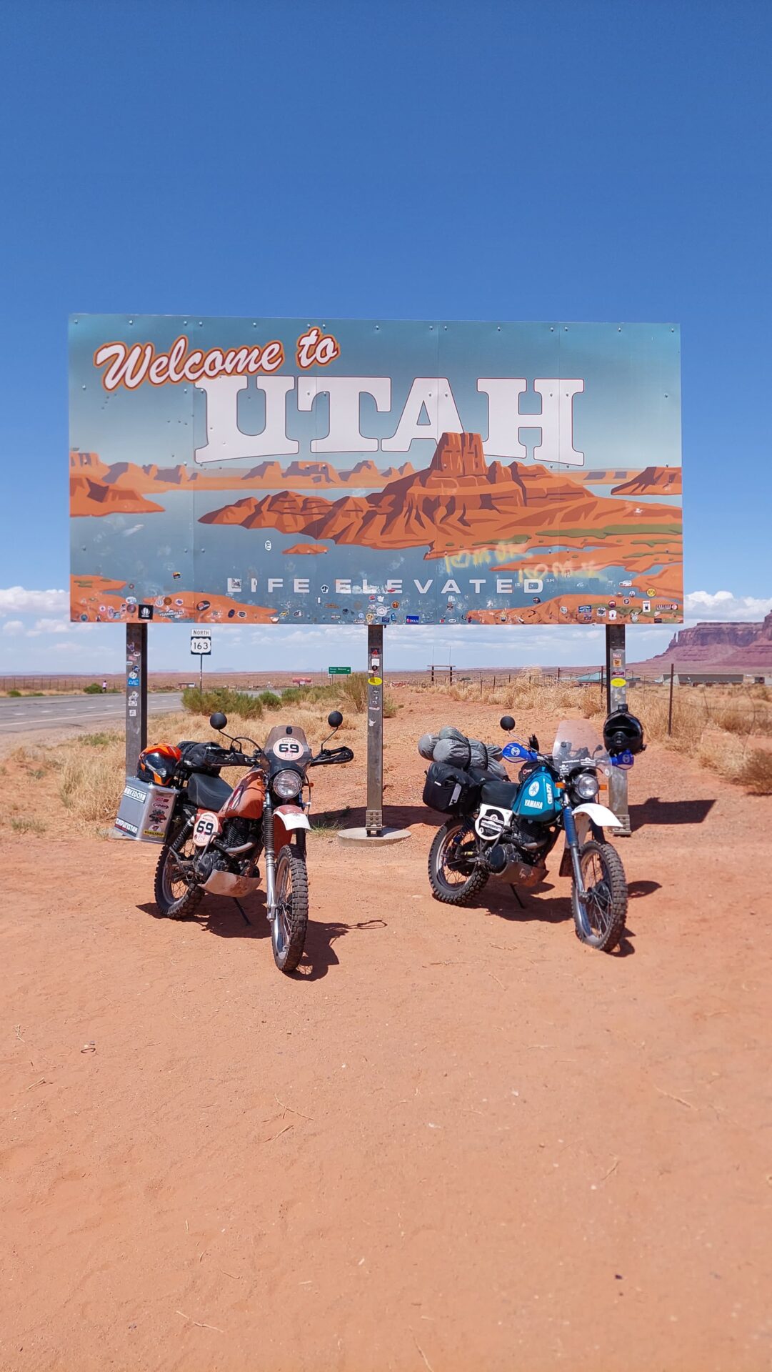
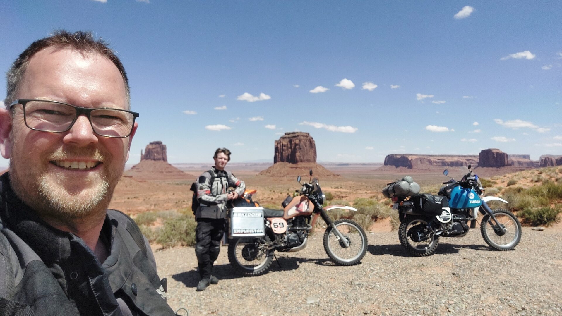
Here we are again: Monument Valley on the border of Arizona and Utah. Unfortunately, motorcycles are not allowed on the Scenic Loop. We have to marvel from here.
A similar photo from the first Father and Son tour made it onto a KEDO postcard.
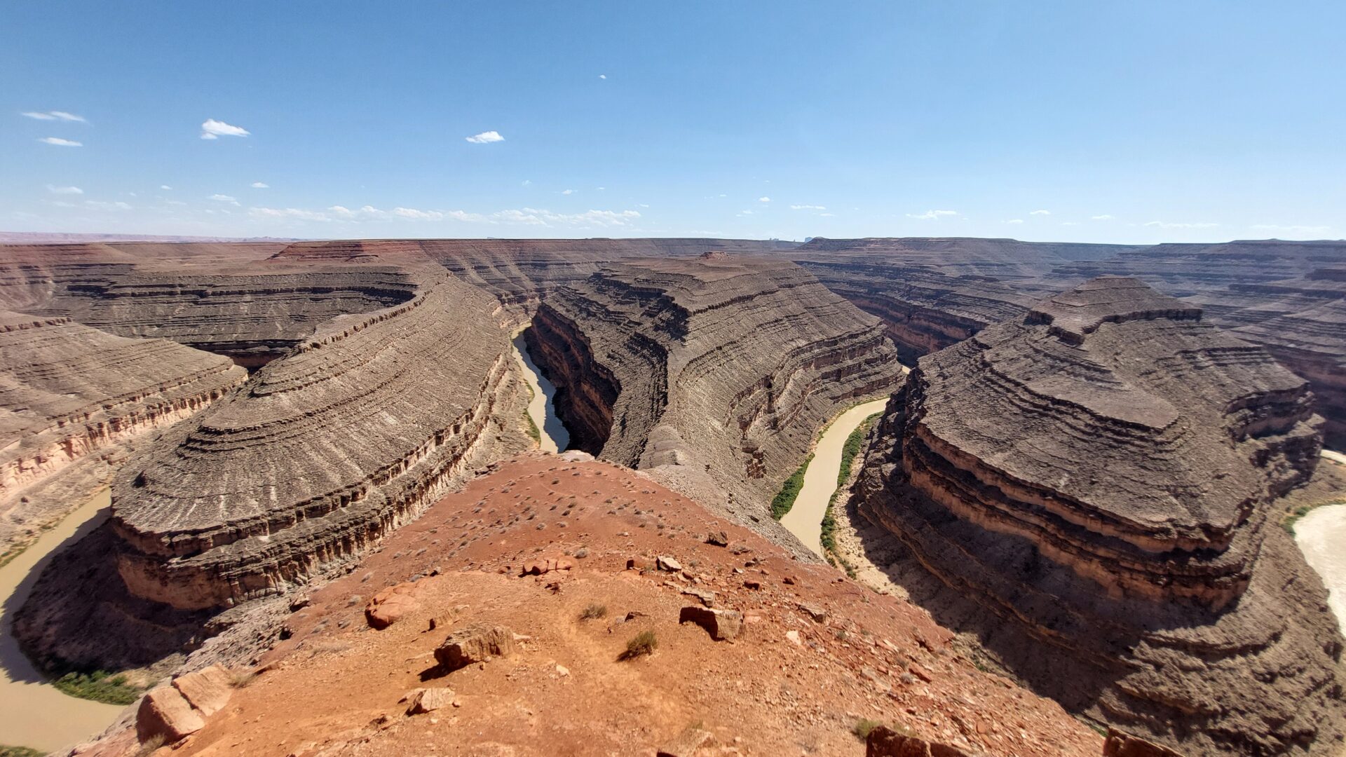
Gooseneck State Park. Only 2 USD entrance fee, but a shady spot and Starlink WLan. Very nice.
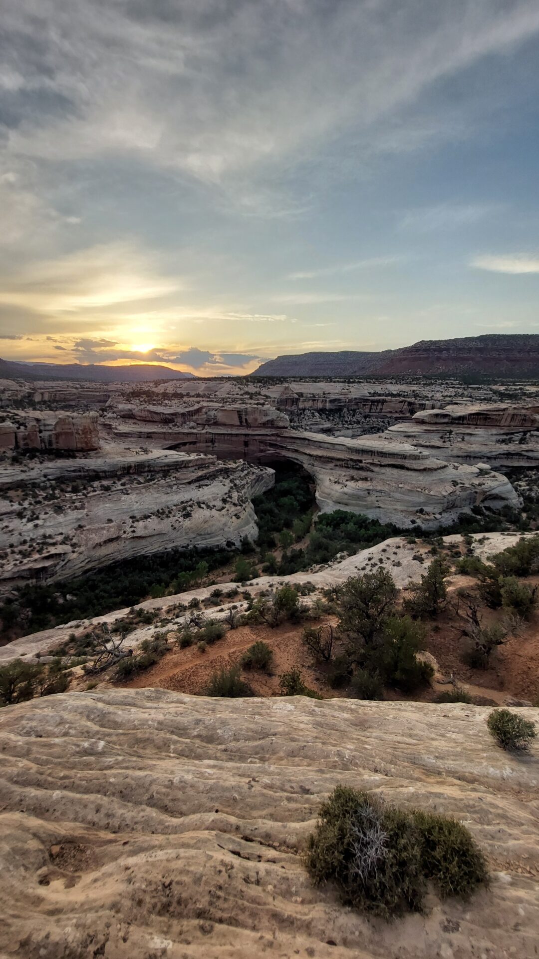
We drive back to Mexican Hat to refuel and then take the cool route via the Moki Dugway to the Natural Bridges Monument. There we booked one of 13 camp spots online in the morning.
I get up early in the morning to dismantle the Ginger's electrics. Using the multimeter, I discover that the diode is intact. The fuse also has continuity from the positive battery terminal to the headlight. I am at a loss.
Once we arrive at Natural Bridges, we pitch our tent and drive into the park on the loop in the sunset. We walk the short trail to the third bridge and are thrilled.
After that, it's already 9.00 pm. We have thin spaghetti with corn and ketchup.
It worries us a little that we are the only ones on the loop and we hope that no barrier has been closed. Lasse films freehand with his cell phone.
We don't get up and pack until 8.00 am. I traipse to the visitor center to maybe buy some drinks - but they don't have any. Just a water dispenser with chlorinated water.
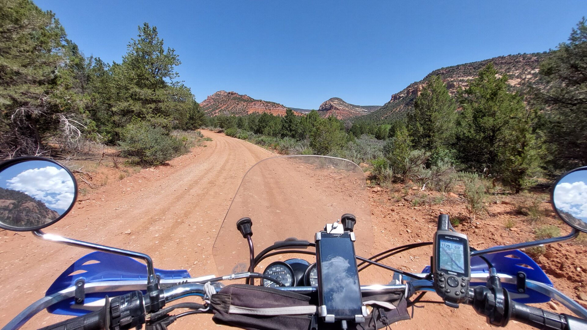
We head east. 10 miles before Highway 191, we turn north onto Cottonwood Road. Super!
I thought we were going straight into canyon country, but no. We drive into the mountains and come to a forested area and up to 2,600m. It looks more like Oregon.
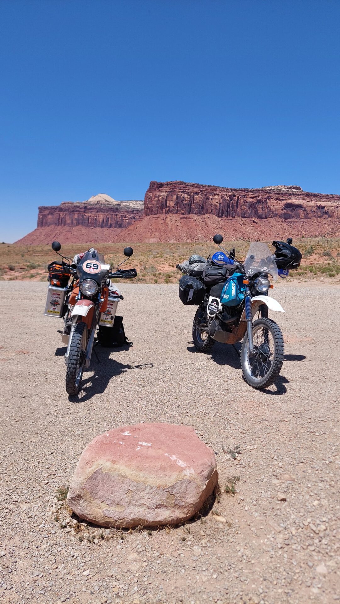
We only approach canyon country at the end of the route when we meet the 211. However, we turn east to drive to Monticello for gas and shopping.
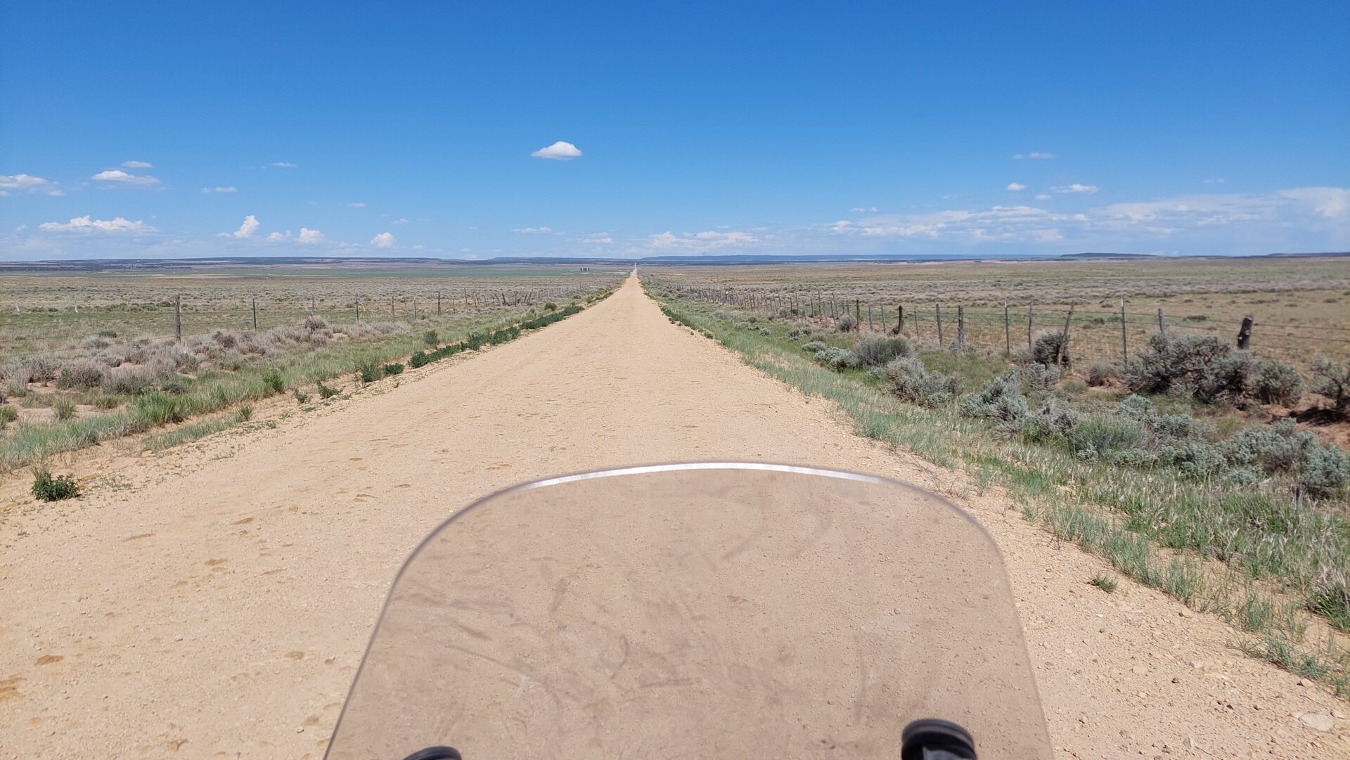
From here, we want to ride the section of the TAT that Peter and I skipped in 2019 in order to ride to Needles Outlook.
The TAT piece was not so convincing. It had something of Oklahoma about it. Very straight and agricultural.
But the second part to Moab over the Geyser Pass was great. The pass is at 3,200m and we pass snowfields
Uphill, it was almost hard enduro. The TAT deviates from the normal track and leads over an ATV trail.
We have to help each other and maneuver past a tree trunk.
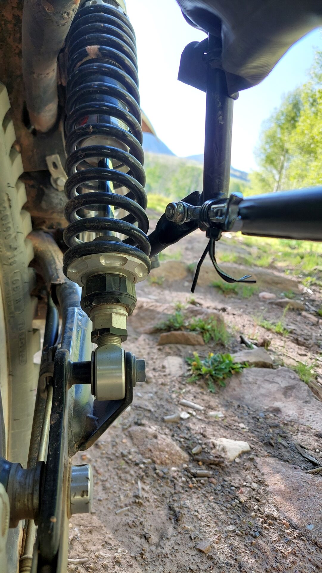
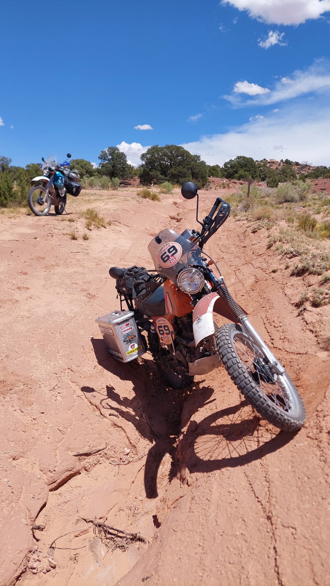
A bracket on the luggage carrier broke off on Lasse's XT. We fixed the breakage with an 8 mm box wrench and cable ties.
It's 7 p.m. and we want to get to Moab. It probably takes just as long on the road as it does on the TAT ... so we continue on the Trans America Trail.
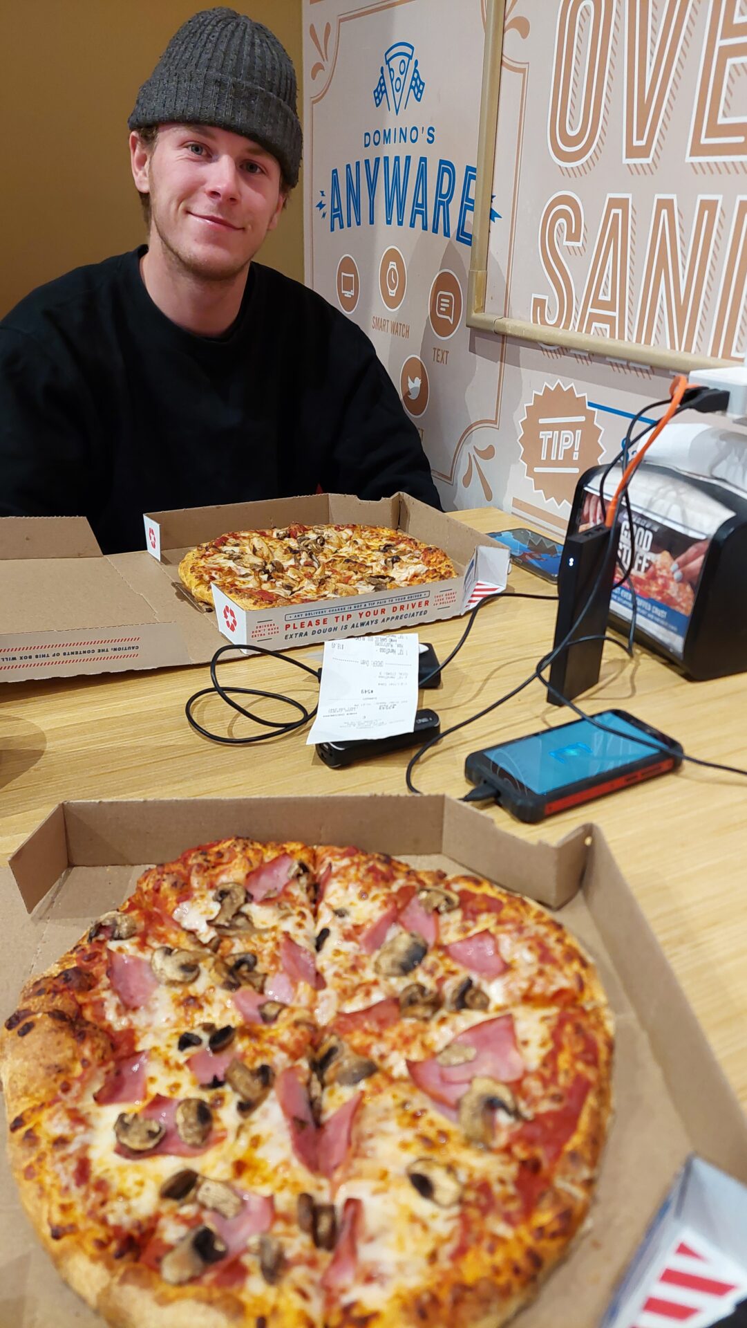
We arrive in Moab at around 8.00 pm. The first campsite is full. The Apache Motel is also full. I've already been there with Peter and Robin. But there's still room at the next campsite. Showers and to Dominos.
Because there are power sockets at the tables and all our devices and power banks are empty.
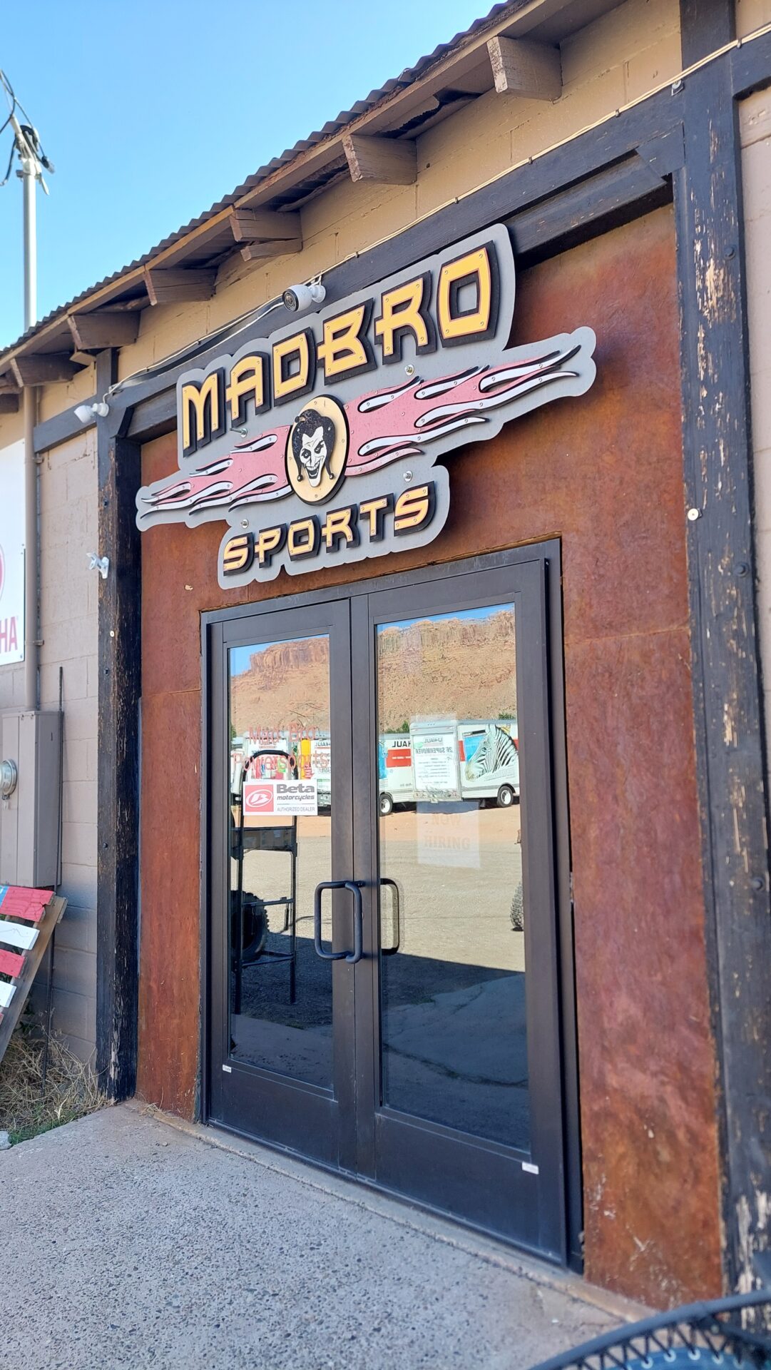
I take the Ginger to Mad Bro, where I bought a tire and 2023 chain spray in 2019. Unfortunately, they didn't have a battery for us, but they welded the luggage rack for me.
At the turn-off, a Jeep driver stops us and asks where we got the tanks. He has XT and TT himself and wants to drive TAT again, but only gets the Clarke tanks in the USA, which are too small.
We drive the cool, challenging route to the bridges, park and walk the 10 minutes there. You can simply walk over the natural bridges without railings. Very nice! Again and again!
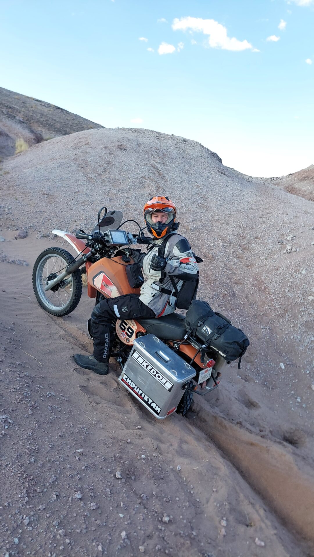
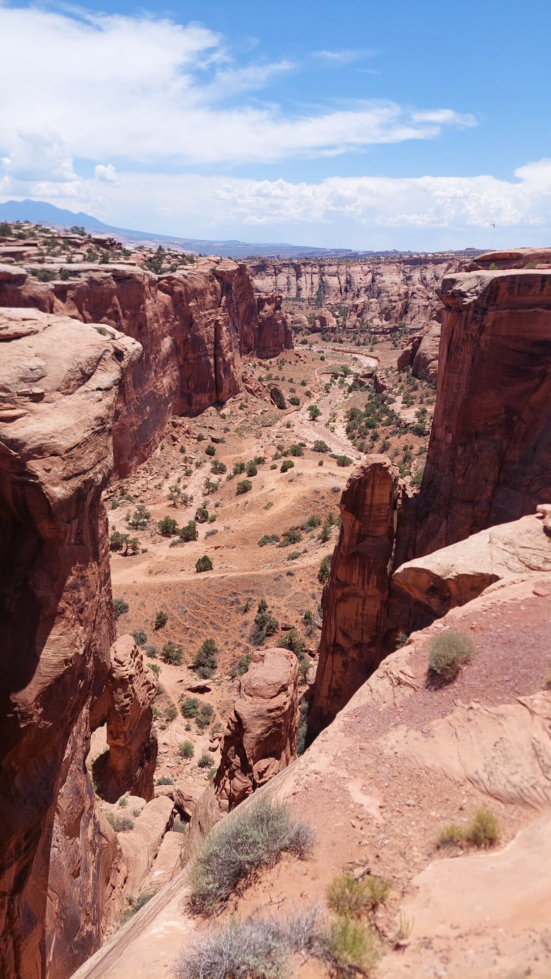
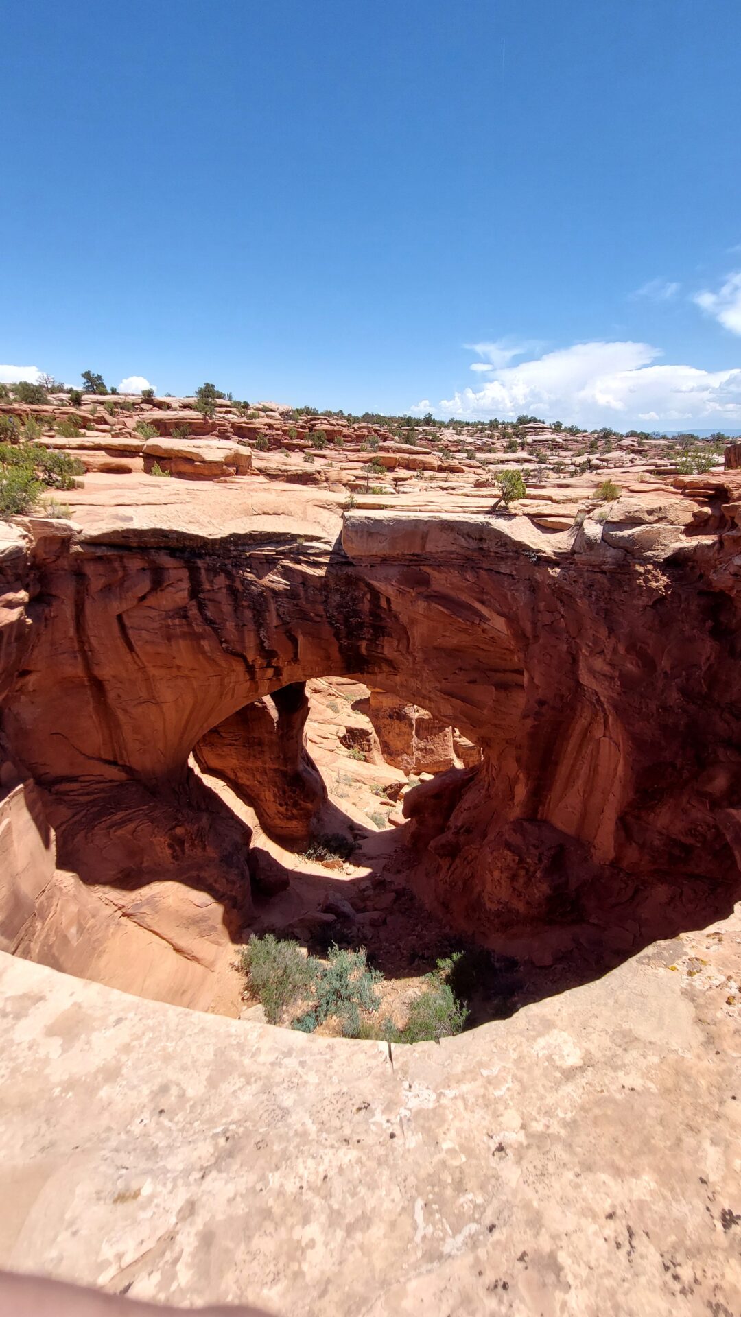
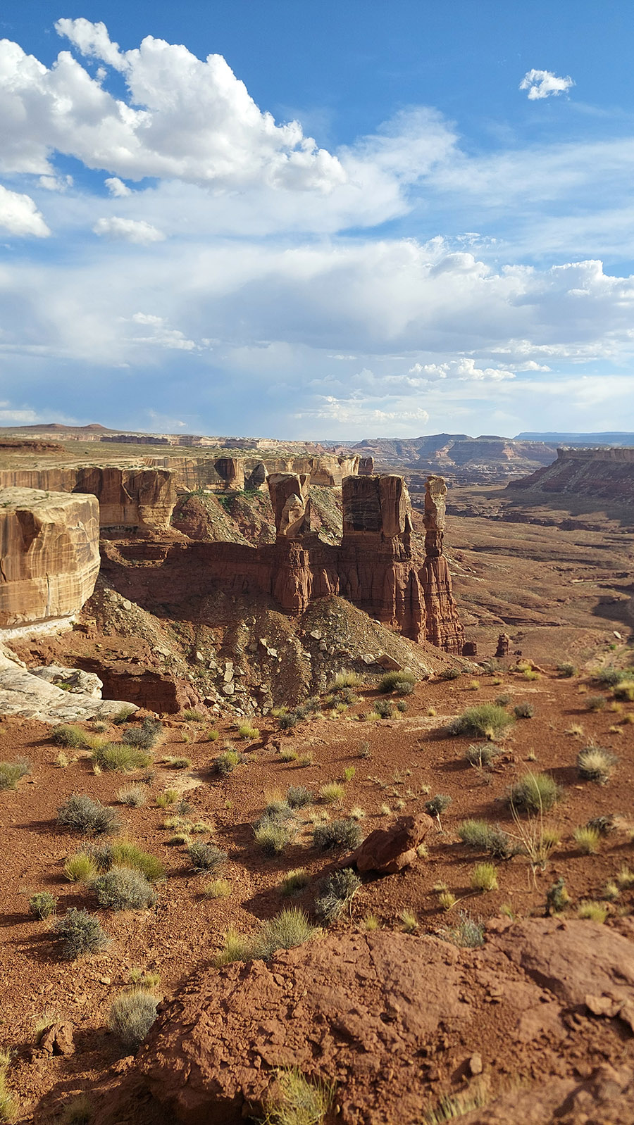
From Moab in Utah, you first take the TAT (Trans America Trail) to the Gemini Bridges (natural bridges).
The route is quite challenging. Stony at first and then sand almost throws Lasse off course.
The Gemini Bridges are two natural stone bridges that lie parallel to each other and you are on top of them. No barriers and great views.
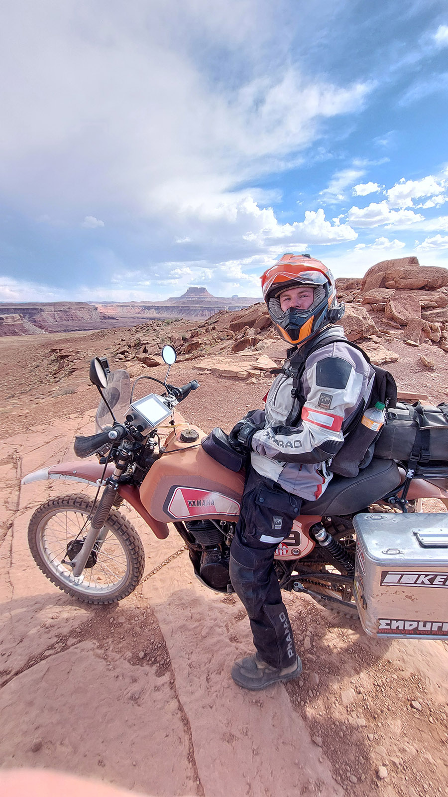
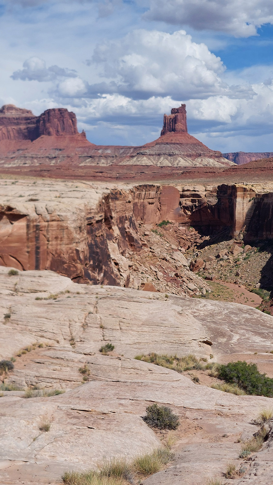
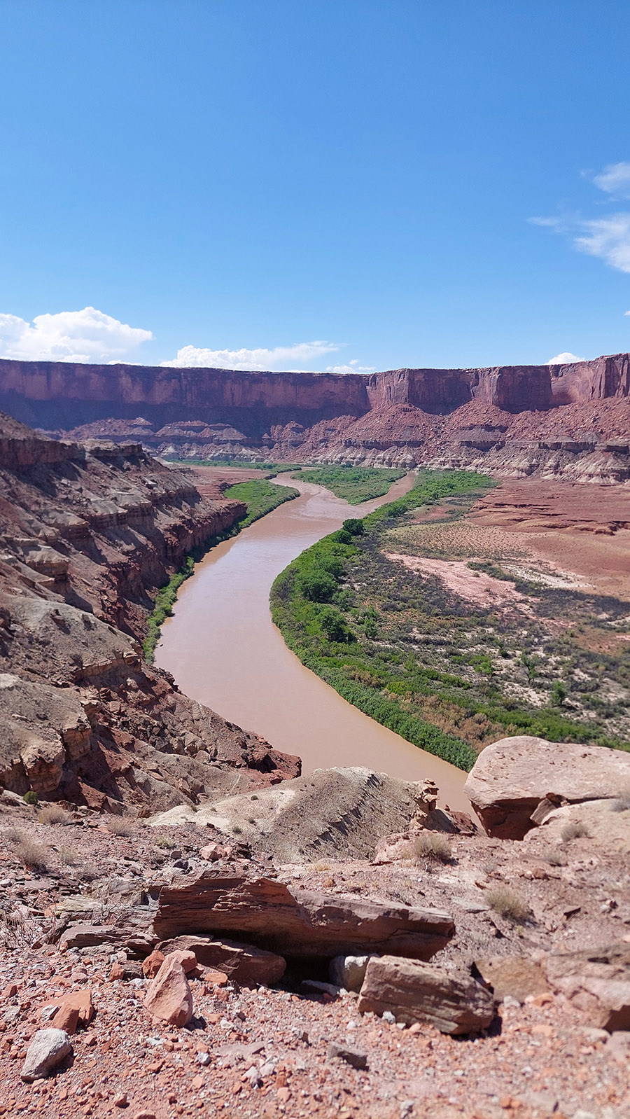
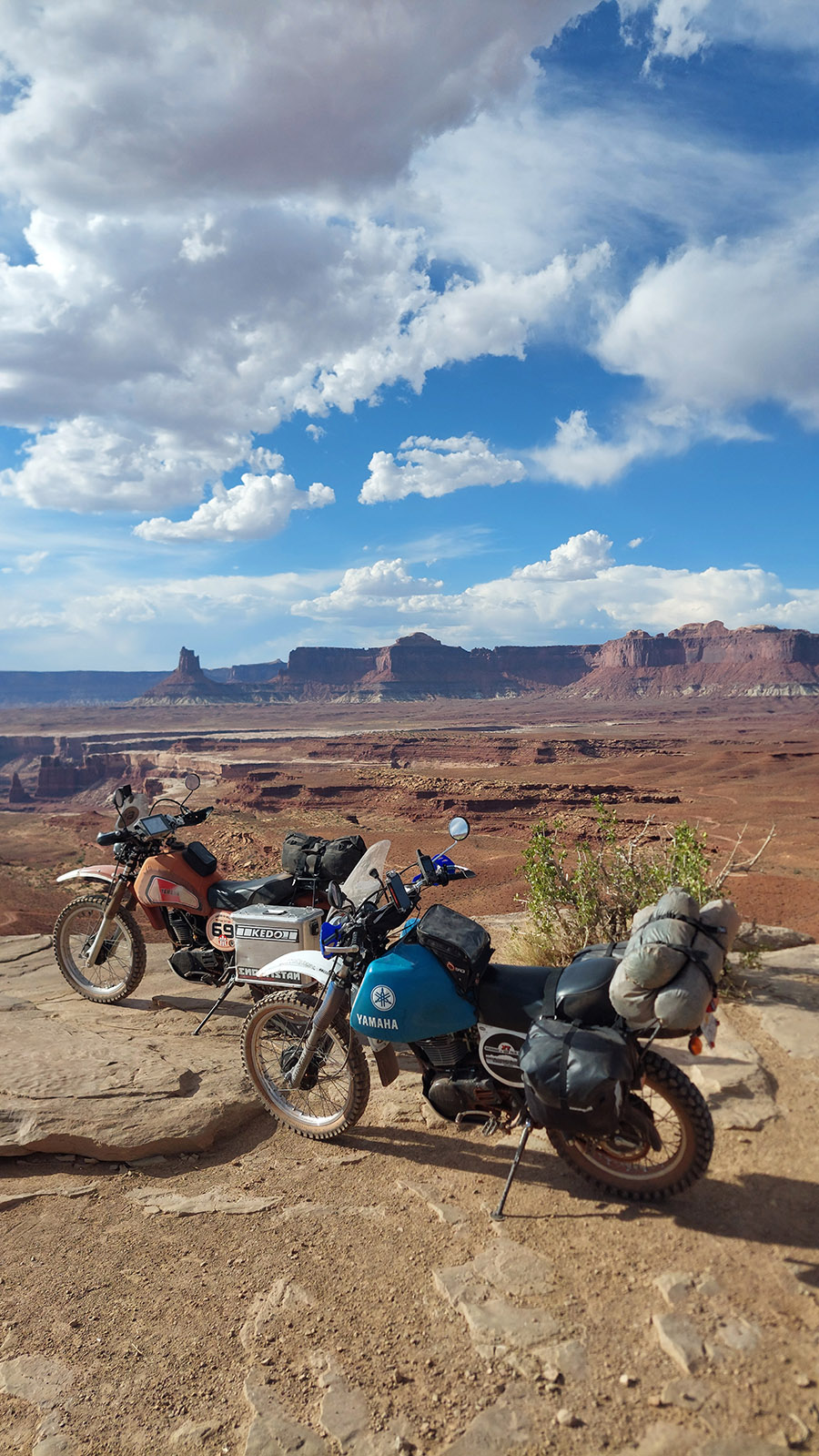
Our plan for the day: take the White Rim Trail into canyon country. The track runs south-east along the Green River and turns north-east above the mouth of the Colorado River. We want to camp there.
Back at the parked XTs, we notice that the panniers on the blue XT are gone. Stolen??? What kind of off-roader steals panniers from a motorcycle???
No, we suspect that they fell off during the rumble. So back they go!
We're in luck! The jeep driver with whom we had talked about large tanks for XT500s at the start of the track picked up one pannier after another and wondered when we would be back.
The White Rim Trail is harder than I remember. We work up quite a sweat and have to help each other here and there. But the landscape makes up for everything. Beautiful!!!
Lasse got stuck uphill and I help him to start again.
It's hot, there's no shade and the route is more difficult than I remember.
On the east bank of the Green River, the route heads southeast and then turns northeast north of the confluence with the Colorado and continues along the Colorado.
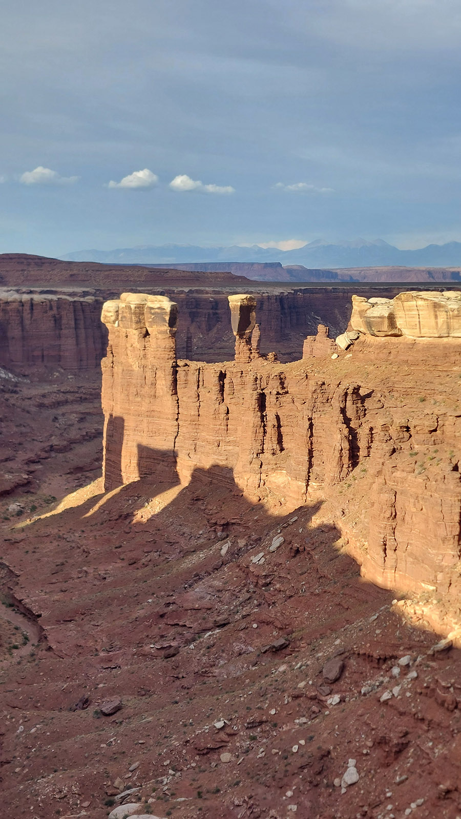
Here you can clearly see why the White Rim Road is called that.
Lasse tried another stunt, but there are deductions in the B grade.
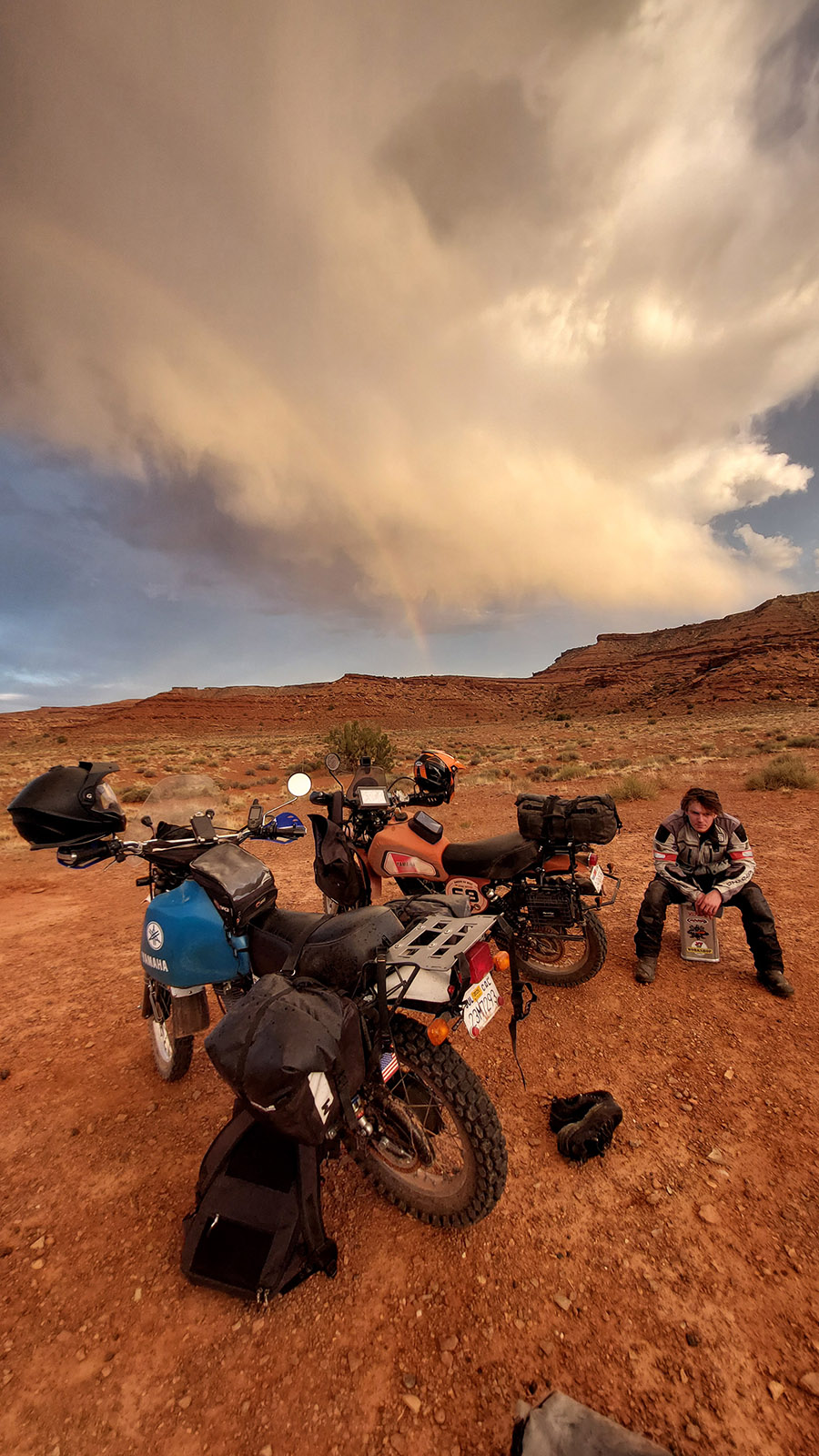
Our water is slowly running out. And we're still on day one ... how is that supposed to work?
